
Alabama ZIP Groups to Verify
This opening table shows the regional number bands documented in Alabama's geography research. It is not a list of every active delivery code, and its broad area labels do not assign a particular town or post office to an individual code. The research did not transcribe the full 2026 Census Gazetteer or a complete USPS directory. Treat each band as a way to organize a check, then use the official Census files and an exact address lookup before naming coverage.
| ZIP | Areas Covered | Post Office | Notes |
|---|---|---|---|
| 350xx-352xx | Central and north-central Alabama, including Birmingham metro and nearby rural routes | Verify preferred office and city name with USPS | Broad band only; exact code-to-area matches are not transcribed here |
| 354xx-355xx | West-central and northwest Alabama, including Tuscaloosa, Walker, and Marion-area communities | Verify preferred office and city name with USPS | Check Census county and place relationships at edges |
| 356xx-359xx | Huntsville, Decatur, Florence, Gadsden, and northeast or north Alabama | Verify preferred office and city name with USPS | Metro suburbs may use a mailing city unlike the municipality |
| 360xx-364xx | Montgomery, east-central, Wiregrass, and south-central communities | Verify preferred office and city name with USPS | County and postal-city edges can diverge on rural routes |
| 365xx-366xx | Mobile Bay, Mobile, Baldwin, and Gulf Coast communities | Verify preferred office and city name with USPS | Check cross-county, PO-box, and unique-use cases |
| 367xx-369xx | Black Belt, southeast, and southwest Alabama | Verify preferred office and city name with USPS | Unincorporated places and rural routes need address-level review |
| Cross-border ZCTAs | Statistical areas partly in Alabama and an adjacent state | USPS lookup decides a specific delivery point | Census examples include 30165 and 31905; recheck current use |
These are supported regional groupings, not an exhaustive postal directory. Do not infer a specific post office or neighborhood from a band alone. A ZCTA can be noncontiguous, partly across a state line, or absent even when a valid delivery code exists. Check each specific code against the official file and use USPS for the delivery address under review.
Alabama Postal Geography and ZCTAs
USPS assigns delivery codes to routes and facilities. The Census Bureau's ZCTA is a statistical polygon built to summarize data; it is not a live postal boundary. Census explains that the 2020 ZCTA codes were valid USPS ZIPs as of January 1, 2020, but some valid postal codes have no ZCTA. The Census ZCTA guide describes PO-box-only, unique institutional or corporate, mixed-mail, noncontiguous, and zero-population fringe areas.
The distinction affects what a map can prove. A Census shape can help compare broad population or place geography; it cannot confirm that a given street receives mail under that code today. A postal area may serve more than one delivery community, and one named city can include addresses routed through another post office. Use ZCTA when measuring an area, and USPS when checking a street address.
The linked Census explanation of ZIP and ZCTA clarifies these limits. Its definitions show why the statistical outline should not be read as a city line or a complete delivery map.
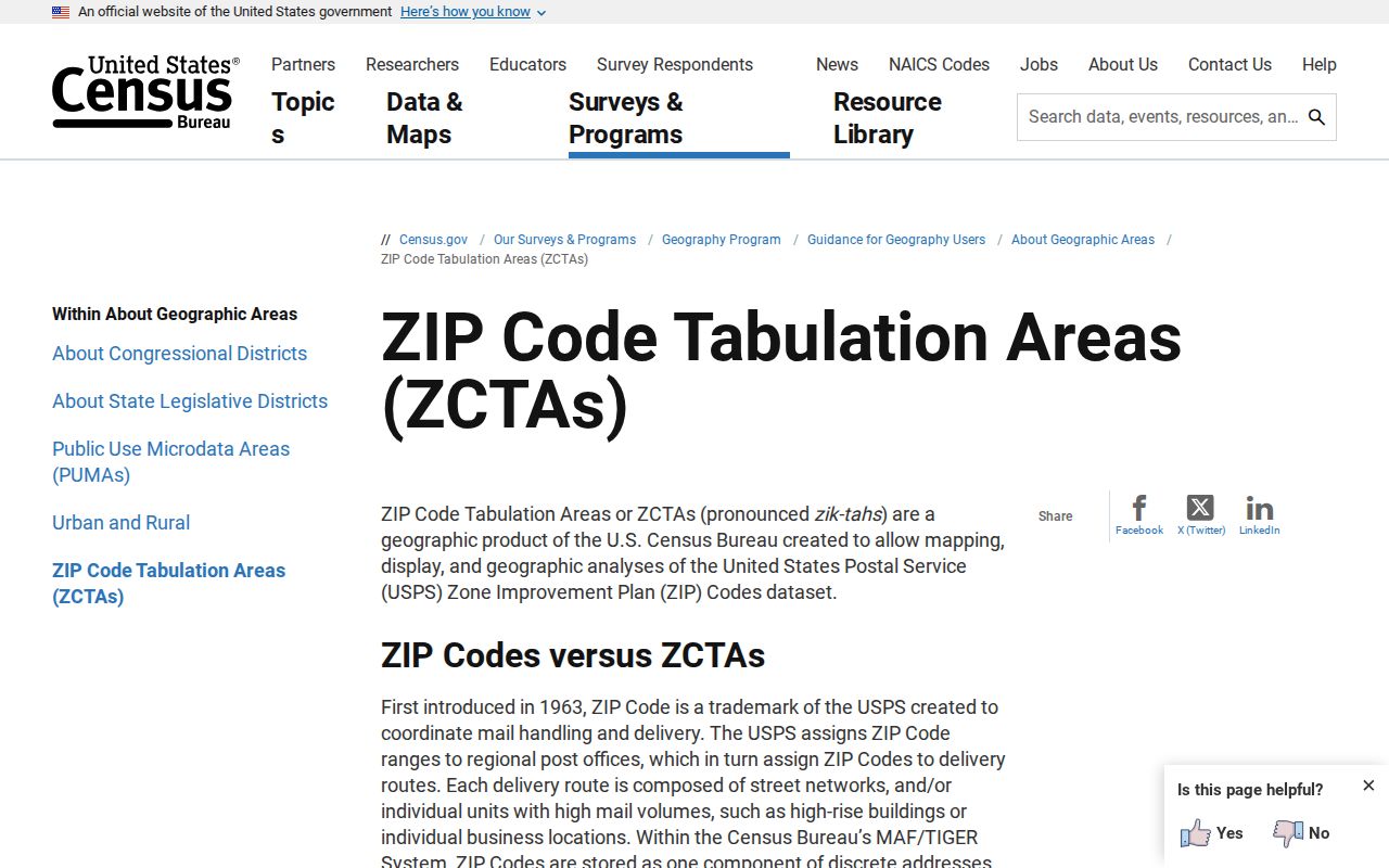
When an address falls near an edge, check Census county and place relationships as a second view, then use the postal lookup for delivery. Record the source and date for both results because the systems describe different things.
Building Alabama's Postal Reference Table
The reproducible statewide method begins with the current official Census Gazetteer download instead of a stale commercial list. The Census 2026 Gazetteer page links the ZCTA file. Use it with Census ZIP-to-county and ZIP-to-place relationship files to create a dated table of codes and statistical links. The Gazetteer is a starting file for ZCTA geography, not a complete live USPS directory.
Keep the source fields separate: ZCTA code, county relationship, place relationship, any partial or cross-border indicator, and the USPS address result used for a real example. A “part” relationship means a polygon reaches across a geography; it does not mean every portion has a postal delivery point. This method makes the statewide reference repeatable without treating a statistical line as an operational boundary.
To verify an example, download the official file, isolate Alabama relationships, retain the county and place fields, and compare a representative street address in USPS. Mark PO-box, unique, mixed-mail, noncontiguous, or fringe cases only when the source identifies them. If the source files do not name a post office for a broad band, leave that cell unassigned instead of guessing.
Alabama State Property ZIP Search
Alabama's State Properties Search accepts Department, Property, City, County, a postal-code field, and Fiscal Year. It is ZIP-capable, but it searches state-owned property rather than private resident parcels. Its fields cannot be used to promise a list of people in a postal area. A screen capture of the official State Properties form shows both the filters and that narrower scope.
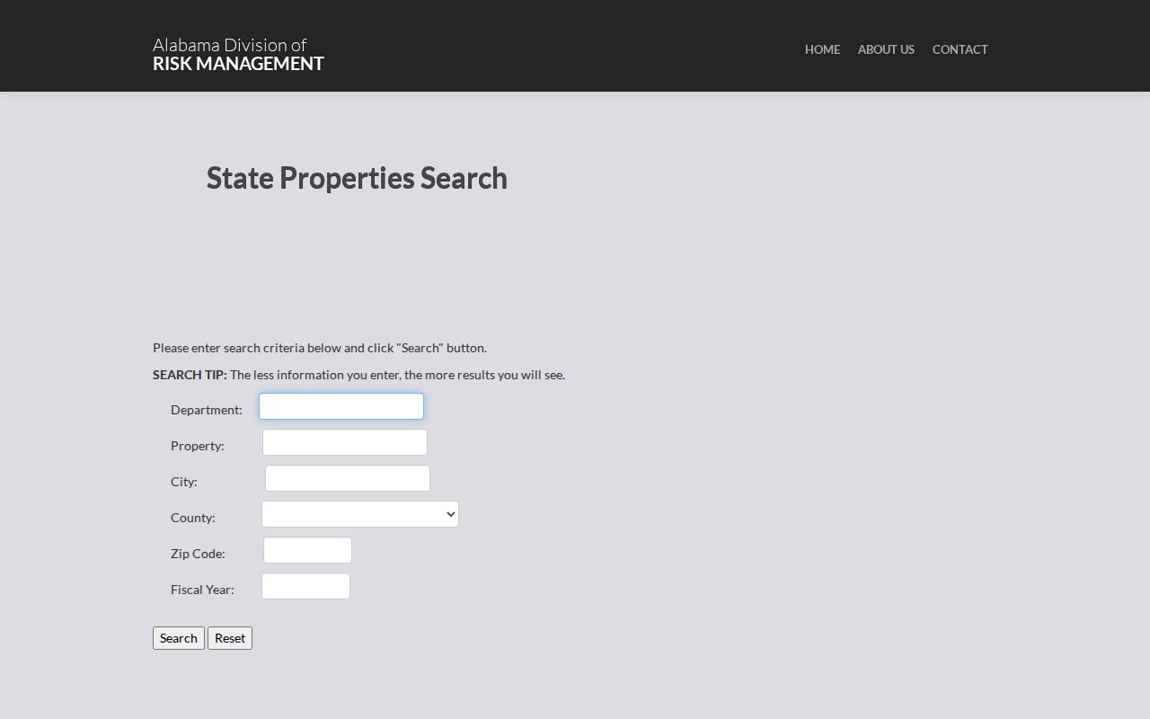
The captured portal fields are useful to document because the postal filter could otherwise sound broader than it is. Department narrows the agency, Property searches its inventory, City and County refine the location, the code field narrows the area, and Fiscal Year selects a reporting view. Search and Reset run or clear the form. No field changes the state inventory into a county parcel roll.
| Search field | Captured form control | Scope or use |
|---|---|---|
| Department | Department selector | Limits the state-property search by agency |
| Property | Property field | Searches a property record in the state inventory |
| City | City field | Filters the state-owned property location |
| County | County field | Filters the state-owned property county |
| ZIP Code | ZIP Code field | Postal filter for state property, not resident parcels |
| Fiscal Year | Fiscal Year field | Chooses a fiscal-year view |
| Actions | Search and Reset | Runs or clears the form |
Alabama County Parcel ZIP Filters
Private parcel research begins with the county that holds the land. The Alabama Department of Revenue's county property directory routes to each revenue commissioner or assessor and links to a parcel search or GIS viewer where one is supplied. County forms are not uniform. Some may offer a ZIP filter, while others search by owner, address, parcel number, or map; research did not establish a statewide county ZIP field.
Because no county or city is assigned here, a specific assessor's ZIP behavior cannot be stated as a statewide fact. Select the parcel's county from an official address, deed, or parcel record, then test the portal's own fields. The county tax office can explain whether a search uses situs or mailing ZIP. A neighboring post office name does not move a parcel into that post office's county.
VoterView is also limited: its address input checks a polling place for one location. The Secretary of State's separate voter-list request form asks for a geography and field choices, with available fields varying by list. Neither tool promises a resident-by-ZIP display. Treat property, voter, census, and postal results as separate records with separate custodians.
Finding Residents by ZIP in Alabama
Use a postal area to narrow the search, then move to the record system that matches the question. A Census ZCTA describes statistical geography; USPS confirms delivery at an address; a county assessor holds parcel and tax data; and VoterView checks an individual location. The postal reference can help route that next step, but the available tools do not combine into an all-residents list.
- Download the current Census ZCTA Gazetteer and identify the Alabama county and place relationships for the code.
- Check a known street address with USPS to confirm the delivery ZIP and preferred mailing city.
- For a parcel, use ALDOR to reach the county assessor and see whether its current form supports a ZIP search.
- For polling-place details, enter one address in VoterView; for a voter-file request, use the separate SOS form and its geographic and privacy rules.
When the next useful question is who owns or is tied to a particular road, continue with the Alabama street directory and its address-level record chain. Keep the postal search and parcel search distinct, especially when the tax mailing address differs from the property's physical location.
Alabama ZIPs Across Different Regions
Alabama has 67 counties, and a statewide search must account for very different settlement patterns. The documented broad bands place Birmingham and nearby rural routes in the central and north-central group; Tuscaloosa, Walker, and Marion areas in the west-central and northwest grouping; and Huntsville, Decatur, Florence, and Gadsden within northern groupings. The south includes Montgomery, east-central and Wiregrass communities, Mobile Bay, Baldwin, the Black Belt, and southwest areas. These regional labels help plan a check, but they do not replace exact county and address verification.
The geography has practical effects. A fast-growing metro suburb may mail under a neighboring city name, while a rural route can carry a postal label for an incorporated place some distance away. A Gulf Coast code may involve a county edge, and a cross-border statistical area can extend beyond Alabama. Before assigning a local office, preserve the county and place relationship as distinct fields, then confirm the mail route with USPS.
The official Census and postal layers answer different parts of the map. Use the regional group only to choose a starting area, then record the exact address check, county result, and source date for any later property or voter search.
Alabama ZIP and City-Line Limits
Postal boundaries do not set Alabama city limits, county jurisdiction, or service districts. A mailing city may identify the post office serving an unincorporated area; a delivery area may cross a county line; and the county assessor may require the county where the parcel sits even when the envelope names a nearby city. School, fire, polling, utility, and municipal boundaries may cross or ignore ZIP lines. Use each authority's own lookup for its service area.
A parcel can also hold more than one address description. Situs means the physical parcel location. Mailing means where tax or other mail is sent. Legal description is the deed's description of the land, such as a lot and block, section-township-range, or metes and bounds. A postal code belongs to a delivery point, not necessarily to a municipality. Keep those terms separate when an old address, rural route, or annexation makes two records look inconsistent.
- ZIP and ZIP+4
- The five-digit code routes mail to a delivery area; the added four digits narrow it to a segment such as a block, building, or delivery unit.
- PO-box-only ZIP
- A code used for post-office boxes rather than a usual street-delivery area.
- Unique ZIP
- A code assigned to one institution or single delivery point, without a conventional neighborhood footprint.
- Carrier route
- A local delivery path used to organize mail service; it is not a county or city boundary.
A ZCTA can be noncontiguous or include uninhabited land, so it is not a legal boundary. If a postal label and a city or county record conflict, keep both values and ask the responsible custodian which one governs the record at hand.
Verify Alabama Delivery ZIPs by Address
For a single delivery point, USPS is the final check for the preferred city name and delivery ZIP. Enter the street address in the USPS address lookup and compare the returned label with the one on a property record or letter. This does not identify the parcel's county or show where a person lives. Use the county office for title and tax records, and note whether an address is the property's location or only its mailing destination.
The USPS page shows the address-based lookup used for an exact check. Its result should be saved with the date, since delivery routes and preferred city labels can change. If a postal result conflicts with a local record, preserve both values and ask the responsible office which field governs the record at hand.
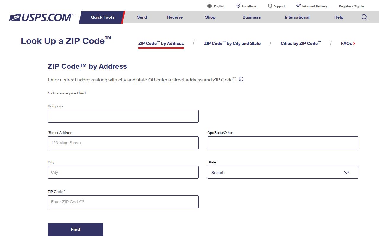
This address-level check completes a reproducible path from broad Census geography to the actual mail route for one Alabama location.
Alabama ZIP Search Has Limits
There is no promise of names by ZIP in the official tools described here. Census data can describe population and other statistics, USPS can confirm a delivery point, a state-property form can find state-owned assets, and VoterView checks a single address. A voter list may be requested for a chosen geography under its separate process, but that product has its own available fields and protected-record limits. These sources answer different questions and should not be combined into a claim about everyone at an address or inside a map shape.
Use Alabama's ZIP directory for lawful personal research, such as planning a property-record search or checking the geography on a family document. Confirm important details with the county or agency that keeps the source record. Do not use a broad postal area to target, expose, or repeatedly contact a person. If a result looks wrong, ask the custodian how to correct or interpret its own entry.
Geography is not identity. A ZIP narrows a place-based search. It does not establish that a named person lives there, owns property there, or falls within a city boundary.